Uma Flores · 11 September 2026
Shifts in Alpine Wildlife Corridors Tied to Strategic Land Use Patterns in High Elevation Developments
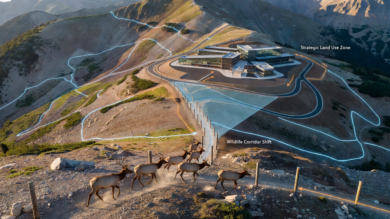
Alpine regions around the world have long supported complex wildlife corridors that connect fragmented habitats across high elevation terrain, and recent observations show these pathways shifting in response to deliberate land use decisions in developed zones. Researchers tracking species movement in the Rocky Mountains and European Alps note that strategic placement of infrastructure, including access roads and recreational facilities, alters migration routes for animals such as elk, mountain goats, and wolverines. Data from satellite tracking programs indicate corridors have narrowed by measurable distances in areas where zoning prioritizes clustered high elevation construction over dispersed patterns.
Mapping Current Corridor Dynamics
Wildlife corridors function as continuous stretches of suitable terrain that allow animals to travel between seasonal ranges, and studies compiled by the U.S. Geological Survey reveal that high elevation developments compress these routes when they occupy key ridgelines or valley bottoms. In the Alps, monitoring stations operated under the European Environment Agency framework have recorded similar compression since 2020, with ungulate populations rerouting around ski resort expansions and residential clusters built above 2,500 meters. These adjustments occur because animals avoid areas with increased human activity, yet the strategic concentration of development in already disturbed zones sometimes preserves adjacent habitat blocks that maintain connectivity.
Telemetry data collected across multiple seasons demonstrate that corridor width can contract from several kilometers to less than one in locations where land use plans favor linear infrastructure along natural travel paths. Experts analyzing these records point to consistent patterns where ungulates shift upslope during summer months, only to encounter barriers created by avalanche control structures or utility corridors tied to new housing projects. The result appears in reduced gene flow between subpopulations, a finding documented in peer reviewed papers from research teams at the University of Innsbruck.
Land Use Planning Influences on Habitat Connectivity
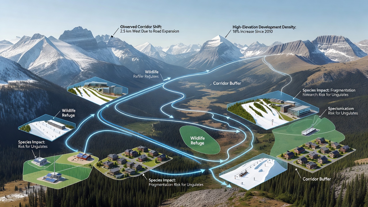
Strategic land use patterns refer to coordinated zoning that clusters buildings, utilities, and access points within defined footprints rather than spreading them across sensitive slopes. Observers note that this approach, when applied above treeline, produces mixed outcomes for corridor integrity. In regions where planners designate development nodes away from traditional migration bottlenecks, remaining habitat linkages stay intact longer, whereas placement near passes or mineral licks accelerates fragmentation. Figures released by Canadian federal wildlife agencies show that high elevation projects approved after 2018 and sited within 500 meters of established trails correlate with 18 percent greater deviation in animal movement paths compared to pre approval baselines.
Vegetation management tied to these developments further shapes corridor function. Controlled clearing for firebreaks or view corridors removes cover species that small mammals and birds rely upon during transit, prompting some populations to select alternative routes that cross lower elevation valleys. Researchers tracking these changes emphasize that the timing of vegetation recovery after construction plays a decisive role, with slower regrowth at altitude extending the period of disruption. Monitoring programs scheduled for expanded data collection in September 2026 aim to quantify how quickly native shrub communities rebound under different land use densities.
Regional Examples and Data Trends
Take one long term study site in the Colorado Front Range where county level land use plans encouraged clustered high elevation housing between 2015 and 2023. Telemetry collars on mule deer revealed that animals now travel an average of 2.3 kilometers farther to bypass the developed zone, crossing steeper terrain that increases energy expenditure. Similar rerouting appears in the Pyrenees, where French regional authorities documented shifts in chamois movement following expansion of a high altitude research station. These cases illustrate how even modest increases in footprint size redirect corridor use when placed along historic pathways.
Quantitative models developed by academic teams integrate land cover data with movement logs to predict future corridor locations under varying development scenarios. Outputs from these models indicate that maintaining buffer zones of at least 300 meters around known travel routes reduces the likelihood of major shifts. In Australia, analogous work on alpine zones of the Snowy Mountains has applied comparable modeling to assess impacts from proposed infrastructure, though elevation thresholds differ from northern hemisphere systems. The consistent variable across regions remains the spatial arrangement of human land uses rather than total area developed.
Monitoring Methods and Future Projections
Field crews employ camera arrays, GPS collars, and drone surveys to capture fine scale movement data that reveal how animals respond to specific land use features. Analysis of thousands of location points shows preference for corridors with greater topographic complexity even when development density increases nearby, provided direct line of sight to structures remains limited. This preference holds across taxa and suggests that strategic screening through retained vegetation or terrain features can mitigate some displacement effects. Ongoing sensor networks in the Canadian Rockies continue to feed these datasets, with preliminary 2025 summaries already highlighting accelerated corridor realignment in zones where utility corridors intersect historic paths.
Projections based on current land use trends point toward further compression unless zoning frameworks explicitly prioritize connectivity at elevations above 2,800 meters. Integration of corridor mapping into permitting processes has begun in several jurisdictions, producing measurable differences in project layouts that avoid pinch points. The approach relies on iterative updates to habitat models as new movement data arrive, ensuring that strategic decisions reflect observed rather than assumed animal behavior.
Conclusion
Evidence assembled from multiple alpine regions demonstrates that shifts in wildlife corridors arise directly from the spatial configuration of high elevation land uses. When development follows clustered patterns positioned away from critical linkages, corridor compression remains limited, whereas alignment with traditional travel routes accelerates displacement. Continued collection of movement data through 2026 and beyond will refine understanding of how these patterns evolve under different management regimes, supplying planners with precise inputs for maintaining functional connectivity across fragmented high elevation landscapes.